Wednesday, July 28, 2010

NT - Kakadu


Kakadu covers an area of 20,000 very diverse square kilometres. Rainforests, wetlands, tidal flats, plunging waterfalls, huge tidal rivers, and massive vertical cliffs are all part of the magic of Kakadu.


Billabongs and wetlands at this time of year are full of bird life, water lilies and crocodiles. One morning we went on a boat tour to the Yellow Water Wetlands where we saw about ten crocodiles cruising the waterways for their favourite food, barramundi.


The Aboriginal culture here at Kakadu is very strong and many of the tours are with Aboriginal guides. Some of the rock art is dated at over 20,000 years old, is incredibly well preserved and very detailed. We climbed Ubirr rock, where much of this art work is painted.. From here you can see the huge escarpments in the distance which border Arnhem Land.

While staying in the National Park there is always something to do and see. Our car has been on many four wheel drive tracks while here and once again for Mike’s enjoyment, lots of water crossings. Our deepest one this time was 60cm which had me very nervous.

The weather has been hot every day between 30 and 35 degrees so we get our walks in early. Most of the walks into the gorges, waterfalls and swimming holes are only about 2 kilometres but clambering over huge boulders in the heat can really zap your energy. The camp grounds we stayed at had resort style swimming pools so we spent the afternoons lazing around them.


The two Uranium mines, Ranger and Jabiluka are located near the main township of Jabiru. We drove out to the Ranger mine one day and typical of all mines has huge trucks, piles of slag, and a deep hole. The only thing that we didn’t see is how they take the uranium out of here. There are no train lines so it must be moved by truck. Beside the mine is a beautiful billabong where we saw our first close up of a Jabiru. It is interesting that with all the ugliness of the mine, beauty is right next door.

Sunday, July 25, 2010

NT-Katherine


We spent three days in Katherine visiting local sites including the beautiful Edith Falls and swimming holes. We then moved out to the National Park camping area beside Nitmiluk Gorge (formerly Katherine Gorge) and spent four wonderful nights there.

Nitmiluk Gorge is a maze of waterways sculptured from the sandstone over countless millennia by the Katherine River. There is 13 gorges making up this stretch and we took a boat tour on three of them and swam in one of the pools between gorges one and two. As fresh water crocodiles are in the area you never feel relaxed while swimming.


There are many walks throughout the park so you can keep yourself very busy and fit during your stay.

Thursday, July 15, 2010

WA-Lake Argyle


This man made lake is Australia’s largest body of freshwater and is 91 times larger than Sydney Harbour. This inland sea was created by damming the Ord River, forming a storage reservoir to supply the huge irrigation schemes in the Kununurra area. The power produced by this dam supplies electricity to much of the Kimberley region.

What was once “Argyle Downs”, a million acre cattle station, originally owned by the famous Durak family, now lies at the bottom of this lake. The Durak family homestead, built by the family in 1895, was dismantled stone by stone, rebuilt and is now a museum not far from Lake Argyle Village.

Lake Argyle Village is the only place to stay on the lake. There are camping sites, cabins and a restaurant. The infinity swimming pool set on the cliff has a breathtaking view of the lake and the cliffs.

This area is a man made marvel. The lake is roughly 75klms x 45 klms and is home to almost 1/3 of Australia’s bird species and has a wetland area. We spent an afternoon cruising the lake seeing many of these birds and crocodiles. A very relaxing and beautiful place to stay only 70klm east of Kununurra and 7klm from the WA and NT border.

WA-Kununurra

Kununurra was established as a town in 1960 to service the Ord River Scheme. The Ord River was dammed in 1971 to form a storage reservoir supplying water to the many farms by gravity fed irrigation channels. This area is now very lush with mangoes, sandalwood forests, cotton, sugar cane, melons and countless other fruits and vegetables.

Ivanhoe crossing is a delightful picnic and fishing spot on the Ord River. We watched people drive their vehicles back and forth just to see if they could manage the low lying crossing. The most entertaining was a ute with children in the back, watching the crocodile lying on the rocks in the middle of the river. This is apparently a good spot to catch barramundi but nobody had any luck the two days that we were here.

Another attraction is the local Argyle Diamond mine which produces approx. 38 million carots of diamonds a year - one third of the world’s production, making Argyle the largest diamond mine in the world. The diamonds are stunning with clear, champagne and pinks. I found one that I liked but we would have had to sell the car- not a good move! The mine will run out of diamonds in the near future so now would be a good time to buy one.

WA-El Questro

While staying at Wyndham we decided to spend a couple of days exploring the eastern end of the Gibb River Road. We re packed the four wheel drive with all our camping gear ready for another adventure.
The road is gravel but was recently graded so the traveling was easy. We stayed at El Questo which is a one million acre Wilderness Park. Within the park there are numerous gorges, rivers to cross, challenging four wheel drive tracks and some fantastic watering holes to swim in. Our favourite was Zebedee Springs which is a permanent thermal spring surrounded by palms and sheer cliff faces. The temperature is 28-32 degrees celsius all year round. The walk in is an easy 750metres one way, crossing the creek several times. We would get up in the mornings, come here for a dip and then spend the rest of the days exploring the area. Mike was in his element with many water crossings, the largest being the Pentecost River which was about 50 metres. During one of the crossings I couldn’t see the running boards so I was a little scared to say the least but the car just keeps chugging over the river stones to the other side. What a gem.


We camped at our own private camping site called Willy Wagtail.
Along the Pentecost River are 25 private camp spots and we were lucky enough to get one. Mike would collect wood in the afternoons and each night we sat around the camp fire with a glass of wine. It is during moments like this that we talk about what a wonderful life we have, the incredible sites that we have seen and the experiences that we have had. The only thing missing on this trip is our family.


As Tom Hanks said in one of his movies “Thank you for my life, I forgot how BIG.”

Wednesday, July 14, 2010

WA-Wyndham


Wyndham is Western Australia’s most northern town. It grew rapidly in the 1880’s as a port for the East Kimberely goldfields, and although the gold declined, Wyndham has remained a port for the pastoral industry in the region, mining companies and produce from the Kununurra area.

At the lookout you can see where five major rivers in the area flow into the Cambridge Gulf. These rivers, the Forrest, Pentecost, Durack, King and Ord are written about in many Australian novels. The area reminded us a lot of Derby especially with the large 8 metre tides and the muddy waters. We also had fresh barramundi for lunch at a local restaurant. It was melt in your mouth delicious.

About 15 klms east of town we drove to Parry’s Lagoon which is a bird watchers dream. Mike and I visited this waterhole a couple of times where they have a bird hide and you can watch the comings and goings of the wildlife. The lagoon is covered in waterlilies and I was fascinated by some of the birds who didn’t seem to want to get their feet wet and hopped from one lilypad to another.

WA-Purnululu National Park and the Bungle Bungles


The very distinctive beehive-shaped domes soaring up to 250 metres above the planes and a network of deep gorges make this area a must see. The 54 klm four wheel drive track in from the highway winds its way across the Maple Downs cattle property before reaching the National Park. We had four water crossings which made the trip exciting for Mike but I always get a little nervous.


We camped in the park for two nights and lapped up the peaceful energy of the place. Each night we had a camp fire, met some other campers, swapped traveling stories and one night were lucky enough to watch a solar eclipse.
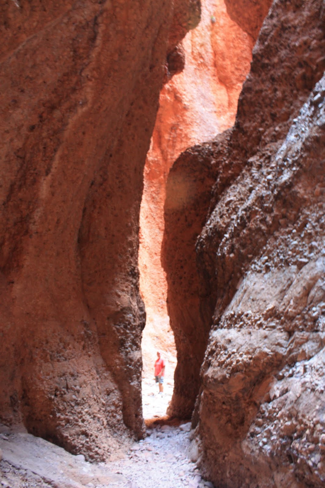
The best way to see places like this is to get out and walk through the gorges. While here, we went on four walks through the domes and gorges and by the time we left we felt that we knew the area well. The scenery is unique and the area is now World Heritage listed.